Residents of earthquake-prone regions now have a modern tool at their disposal to monitor tectonic shifts in real time. QuakeInfo – a long-standing utility available on the App Store – has recently undergone a significant overhaul, introducing a sleek “liquid glass” visual interface alongside several enhanced capabilities.
Core Features and Capabilities
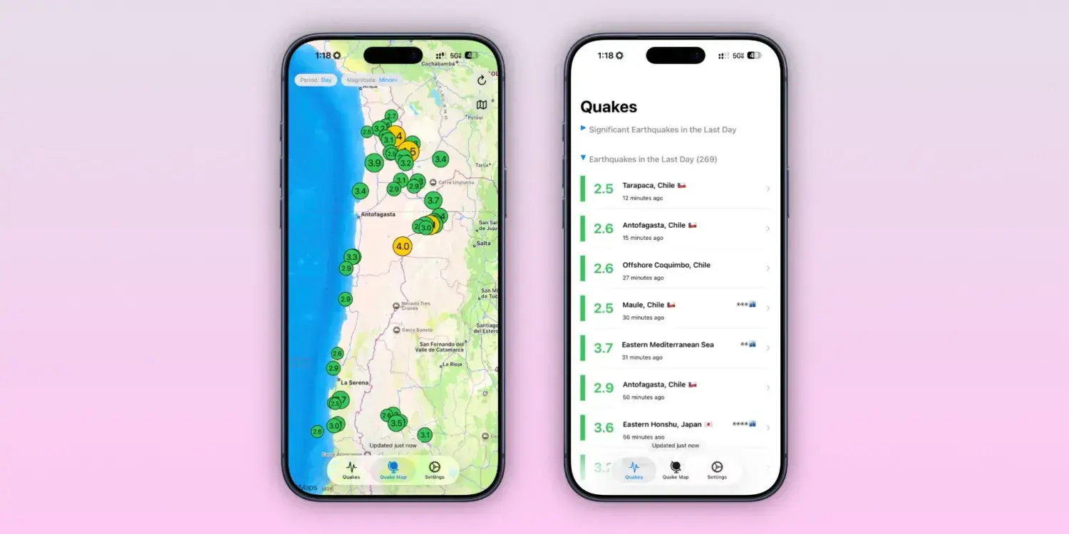
The application aggregates data from major seismic databases in the United States and Europe to provide a comprehensive view of global activity. By prioritizing a central map interface, the software ensures that information is both accessible and easy to interpret. Users can access a detailed list for every recorded event, which tracks specific metrics:
- The exact time and magnitude of the tremor
- The specific location and depth of the event
- The user’s distance from the epicenter
- Proximity to the nearest populated areas
Additionally, the system is equipped to issue immediate tsunami warnings when necessary.

Safety remains a primary focus, as the app delivers location-based alerts and provides essential spatial context for each event. By offering deep metadata for every individual earthquake, the platform aims to prepare users for potential impacts before they occur.
For those interested in long-term seismic patterns, the software includes a feature to analyze historical data from the previous twelve months. This retrospective tool allows users to compare current tremors with past activity – focusing on variables like depth and magnitude – to identify typical regional trends.
Availability and Pricing
The QuakeInfo application is currently available as a free download for iPhone owners running iOS 18.6 or more recent versions. For users who require the full suite of professional functions, a Premium subscription is offered at a cost of 1.99 dollars per month or 9.99 dollars for an annual plan.